
WOLF — Wildlife Operations Live Flight
Real-Time Intelligence for Wildlife Operations
WOLF connects aerial missions, AI-assisted detection, and operational visibility for private reserves and conservation teams working across demanding terrain.
The challenge
Large reserves need better visibility
Wildlife, boundaries, and environmental conditions shift across valleys, bush, and open plains — faster than ground teams can patrol every sector. Without timely aerial context, operators respond with incomplete information.
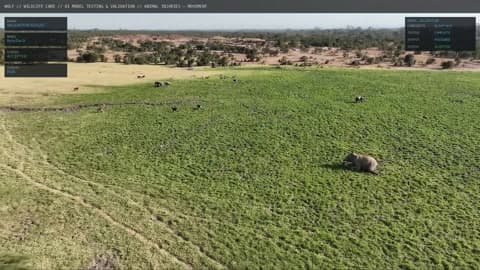
Aerial intelligence helps extend monitoring across difficult-to-cover areas: supporting wildlife awareness, perimeter checks, and environmental observation from a consistent operational picture.
Operating model
Flight → Intelligence → Command
One connected sequence from aerial capture to operator-ready information — not three disconnected tools.
Flight
Capture the mission
Drone missions collect aerial imagery and mission information over the reserve — with telemetry preserved for review and correlation.
Intelligence
Process what matters
Configured workflows analyze imagery to produce observations and detections aligned to reserve priorities — from wildlife cues to perimeter and environmental missions.
Command
Operate with context
Operators review results in the WOLF platform — planning sorties, monitoring activity, and using mission outputs according to implemented capabilities.
The WOLF platform
Mission control for reserve operators
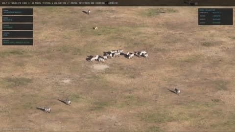
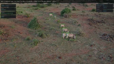
Authentic WOLF command views — plan missions, review aerial intelligence, and follow detections on desktop and mobile. Screens reflect implemented interface capabilities; live data varies by deployment.
- Mission planning and monitoring in one workspace
- Aerial video and detection context for field decisions
- Historical mission records for briefing and review
- Designed for reserve teams — straightforward to operate
Wildlife
Monitoring and AI-assisted detection
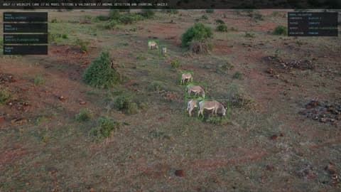
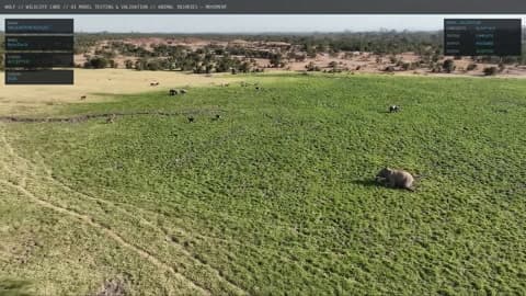
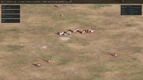
Aerial imagery feeds workflows for animal detection, counting, species identification, injury cues, and tracking where those missions are configured. Outputs support census, monitoring, and animal-care coordination — with capability mix defined per deployment.
Detection pipelines are mission-specific; not every workflow is deployed at every site.
Operations
Drone missions and situational awareness
Operators use drone missions to understand activity across the estate — planning sorties, monitoring flights in progress, and reviewing aerial context when incidents arise. WOLF is built around reserve-led operations rather than a permanent external flight crew for routine intelligence.
Autonomy and aircraft compatibility depend on agreed scope and infrastructure.
Reserve & environment
Containment, security, and land awareness
Aerial passes support perimeter inspection, intrusion monitoring, and security documentation alongside environmental observation — fire and thermal perspectives, flooding and access, water and grazing conditions where relevant missions are in place.
Environmental and security workflows are configured to operational priorities — not automated responses.
Working together
How engagement works
A practical path from first conversation to a defined solution — presented as our proposed engagement process, tailored to each reserve.
- 1Discuss your reserve’s operational priorities and constraints.
- 2Assess terrain, mission requirements, and existing infrastructure.
- 3Define a suitable drone, data, and software workflow for your context.
- 4Agree scope, validation approach, and rollout steps before deployment.
Discuss your reserve with WOLF
Tell us about your terrain, missions, and operational priorities. We will explore how aerial intelligence fits your workflow.
Discuss a project